Research at KUDAR
Modeling the Maritime Cultural Landscape of the Amalfi Coastline
Begun in 2016, the ongoing study of the maritime cultural landscape of the Amalfi coastline is a multidisciplinary project incorporating archaeology, history, ethnography, and coastal geo-morphology to model and to understand changes in the local community’s relationship with the sea over the past millennia.
Project Background
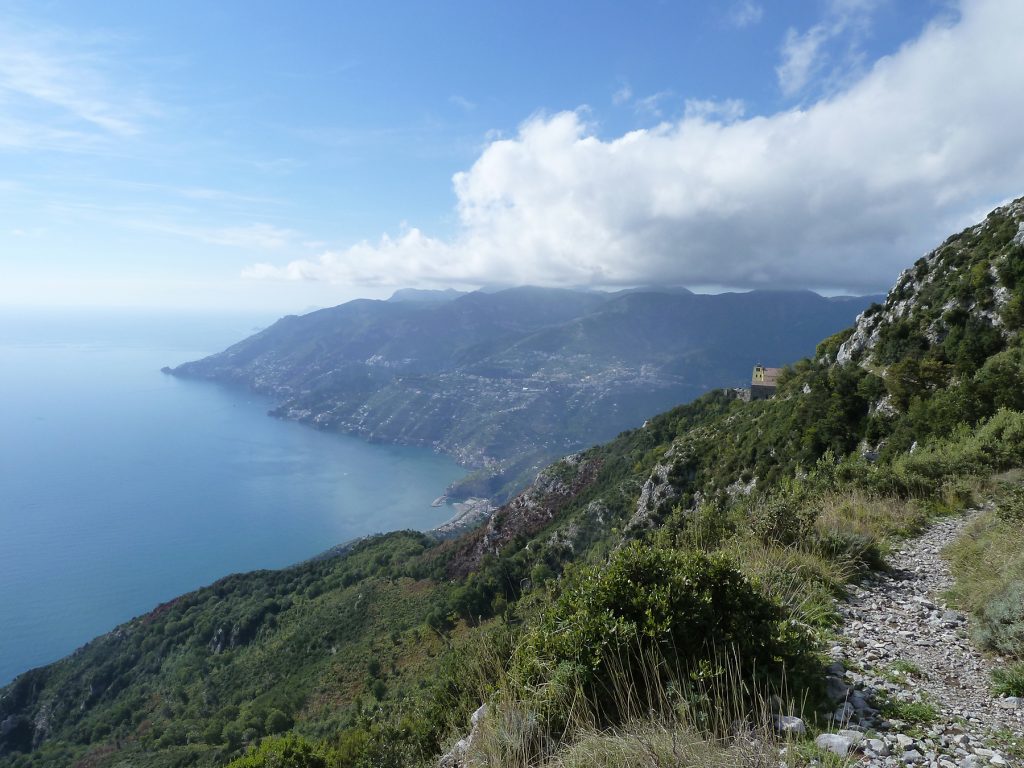
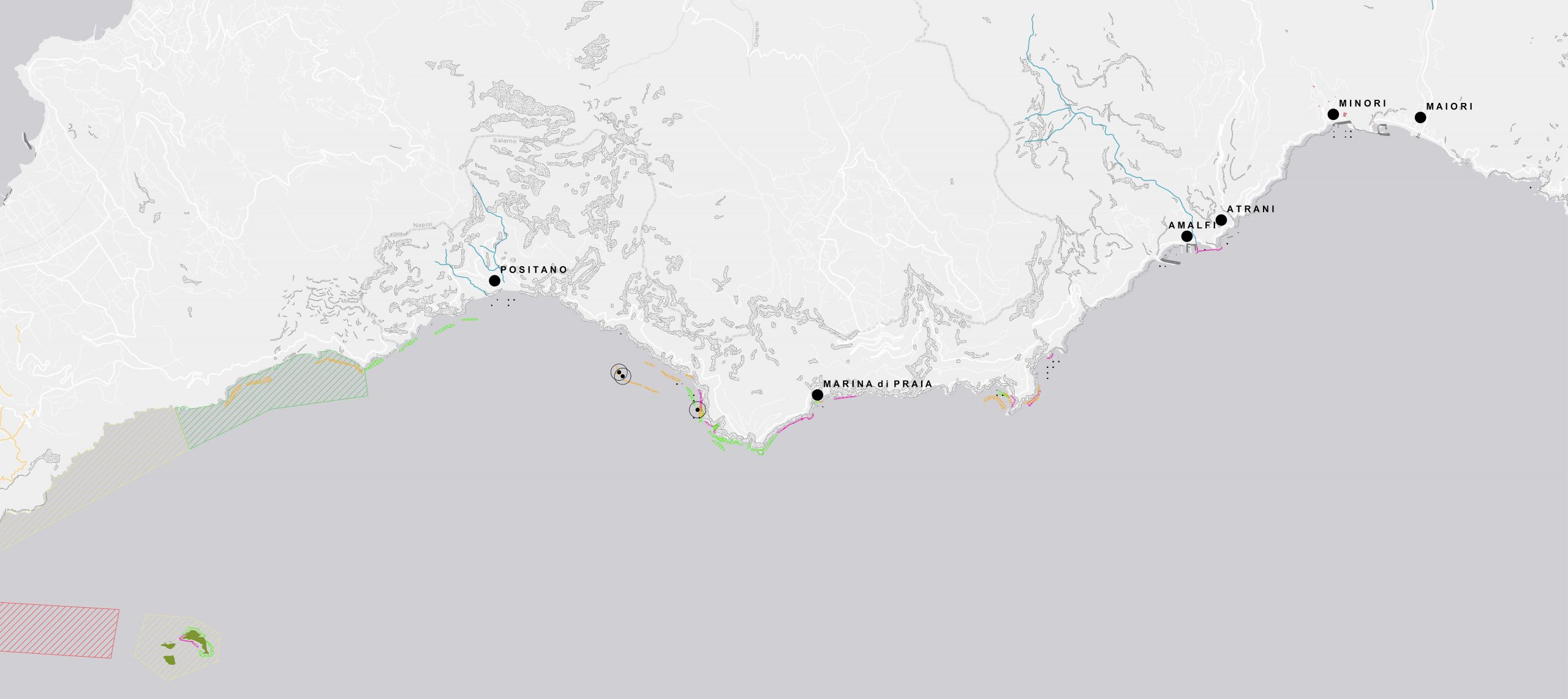
Under the direction of Dr. Matthew Harpster, this diachronic study focuses on the Amalfi coastline between Salerno to the east and Punta Campenella to the west. With its coarse topography and narrow river valleys limiting settlements’ dispersal to the coastline, as well as a continuous history of occupation from the early Paleolithic era to the present day, this is almost an ideal environment to study the construction and change of maritime cultural landscapes.
Equally, there has been little maritime archaeological research of this coastal region. Likely prompted by archaeological activity in the 1960s at the submerged sites at Albenga and Baiae, as well as the creation of the Centro Studi Archeologia Subacquea, maritime archaeological work appears to have begun along the Amalfi coastline in the same period. Some of this work focused on the relatively shallow seabed between Positano, Marina di Praia, and the Li Galli islands – divers began reporting the presence of amphorae and other pottery in this area during this decade, for example, and at least 17 of the amphorae in the Minori Museum were recovered from this location in 1960. Fourteen of the lead-anchor elements in the museum also came from this area, recovered in 1963 and 1964.
Other work, however, focused primarily on the harbour of Amalfi, searching for evidence of Amalfi sommersa. Beginning in 1970, Plinio Amendola and Guido Picchetti, with the Centro Sub di Sorrento, investigated the harbour’s seafloor, and found pottery fragments and a large submerged feature they claimed was part of the medieval city’s walls. Harold Edgerton and his colleagues, however, examined the same feature in 1979, and claimed it was not architectural but a natural accumulation of debris from the Canneto River mouth emptying into the bay. Yet more recent analysis in 2004 argues that this is a man-made feature and may be the 13th-century pier made by Cardinal Pietro Capuano.
Elsewhere along this coastline, however, maritime archaeological research appears to have been limited to two other examples. Begun in 2004, the Archaeomar Project found two deep-water sites from the Roman and late-Roman periods near Capri, and in 2013 Paolo Pecci finished his research of a Roman-era pila or mooring-stone at Punta Fuenti.
Fieldwork and Research Goals

Conducting a new series of systematic underwater surveys along this coastline, therefore, could add to this collection of previous work and add to the national corpus of submerged heritage as well. Simultaneously, however, as our survey results could add to the ongoing AMD project, they could also be a key component of a larger project attempting to answer a number of questions in relation to this region’s maritime landscape: How can historical, ethnographic, and geo-morphological studies contribute to our archaeological studies of this landscape? What are its tangible and intangible elements? How has it changed over time? How can we document and portray these changes? Can we develop methodologies that are applicable elsewhere?
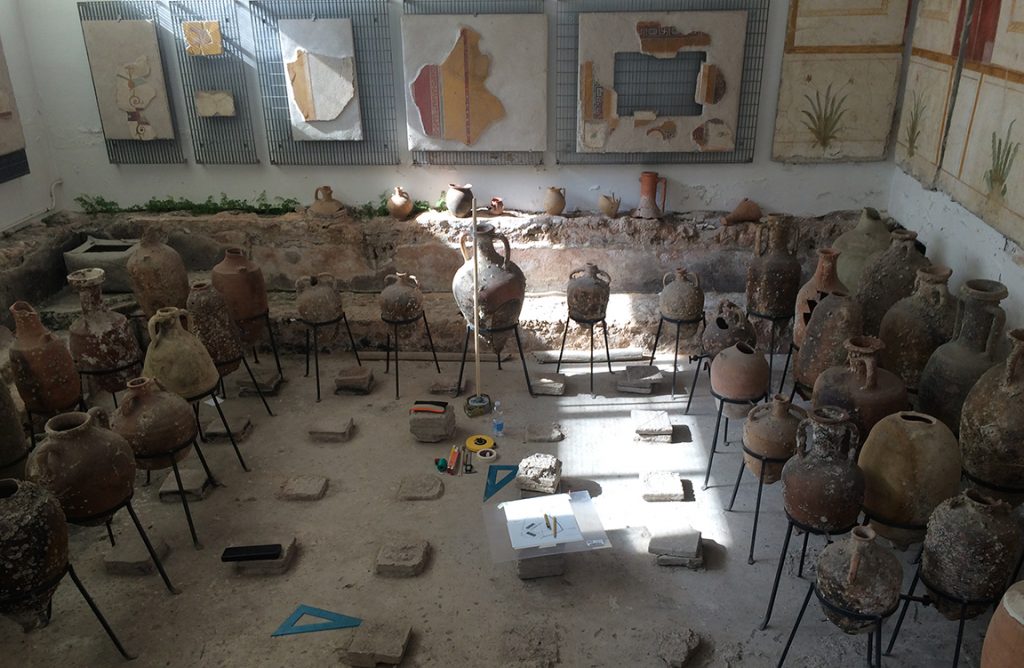
With permission from the Soprintendenza Archeologia, Belle Arti e Paessaggio per le Province di Salerno e Avellino, our first three seasons of work between 2016 and 2018 focused on the center of the peninsula – Amalfi, the nearby coastlines, and the inhabited areas to the east and west – and was roughly divided among scholars focusing on terrestrial and underwater topics. Luca Zavagno and Vincenzo Capriglione, for example, worked in archives and libraries in Salerno and Amalfi to synthesize sources on the changing maritime facades of Amalfi, Atrani, Minori, Maiori, and Cetara. Carlo Donadio, Luigi Ferranti, and Corrado Stanislao, from the University of Naples Federico II, conducted geo-morphological investigations to clarify changes in the actual and relative sea level over the past millennia, and Elif Denel and Özge Demirci catalogued the collection of amphorae in the villa marittima museum in Minori recovered from the seafloor nearby. Under water, a team of six archaeologists worked with Gaetano Milano at Centro Sub Costiera Amalfitana in Marina di Praia, to systematically survey and document archaeological material.
The results of our first phase of work in this portion of the peninsula were mixed. On land, a combination of geo-morphological, historical, and archaeological data is gradually fashioning a model of the peninsula’s changing coastline. For example, two paleo-sea notches representative of wave action at different sea levels in the past, were identified. One, at Gavitella, was approximately 12 meters deep and likely dates to the Würm glaciation whereas the second, near Marina di Praia, was only 1.5 meters deep and reflects the sea level during the Holocene. In addition, evidence of the Medieval-era sea walls in Maiori and Minori is still present. The wall in Maiori, likely dating to the 12th century, extends approximately 200 meters from the eastern boundary of the town to the modern Corso Reginna. In Minori, the wall itself no longer exists, yet an associated defensive tower and the adjacent fossato are still present along the Via Antonio Mancini. Lastly, historical sources attest to the presence of such walls in Amalfi, Atrani, and Cetara, and an arsenal in each city as well; only the arsenal in Amalfi is still preserved, however.
Broadly, therefore, this initial collection of data is creating a rough narrative of this coastline’s maritime facade over the past millennia. The paleo sea-notches, combined with information from other geo-morphological studies, reinforce a general pattern: a dramatic drop in sea level during the last ice age, and a gradual rise to present levels over the subsequent years. Within the Medieval era, for example, the relative sea level may have been slightly lower. The sea walls suggest that the coastal silhouette was different in that period as well. The estimated location of Minori’s sea wall is approximately 130 meters from the present shoreline, whereas the wall in Maiori is now over 200 meters from the present beach.
Our underwater research between 2016 and 2018, however, yielded fewer answers. Briefly, after 63 dives over three seasons we systematically surveyed 21 kilometers of the seafloor; 12 of these dives were over 20 meters deep. During those dives, however, we only found three submerged sites of archaeological interest in this area. Consisting of small collections of less than ten ceramic fragments, such as neck and shoulder fragments and body sherds, we presently suspect these date to the Medieval era. As per our survey permit, these items were left in situ and so are difficult to categorize more precisely. Study of the amphorae recovered previously from the seafloor, and in the local museum in Minori, however, adds to this small collection of data. Among the 44 amphorae on display, 39 are from the seafloor between Marina di Praia, Positano, and the Li Galli islands. Among them, examples from the western Mediterranean region predominate, such as Dressel 2-4 types from Italy and North Africa, Graeco-Italic Vb piccolo, and examples from Spain. Types from farther afield are present as well, however: one Dressel 2-4 type may be from Kos, for example, and there is one Égyptienne Bitroconique 3 from the Nile region.
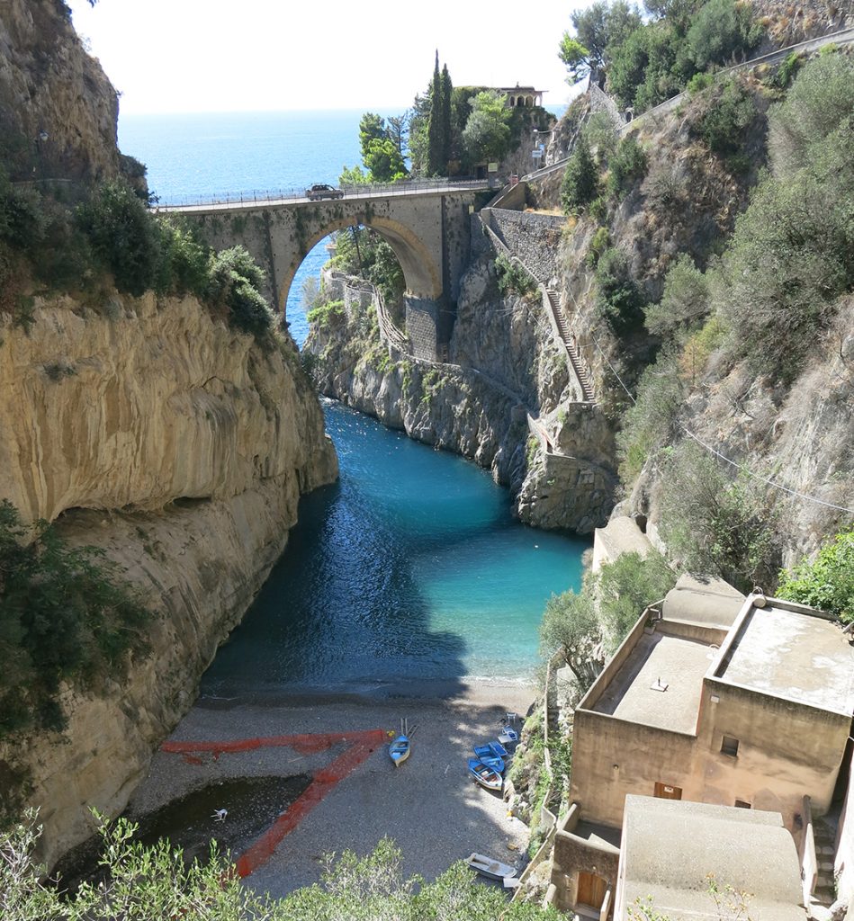
Our second phase of work, presently underway along the western end of the peninsula between Punta Campanella and La Crapolla, has an expanded set of questions to pursue. Similar to previous years, we are still using a combination of terrestrial and underwater investigations to model and to understand changes within this maritime cutural landscape over the past millennia. We have an additional research agenda, however: Why does there appear to be so little archaeological material in situ on the seafloor, while there is a steady history of occupation on land? Is this absence due to looting or particular environmental issues? As we begin to conduct additional underwater surveys in the Marine Protected Area at the western end of the peninsula, we hope to find answers to this unexpected phenomenon.


Support
Our ongoing efforts to model and to understand the maritime cultural landscape of the Amalfi coastline have been generously supported by a variety of individuals, organizations, and institutions. We would like to thank all of them for their time, support, and trust as they give us the opportunity to conduct our investigations in a unique and amazing environment.